FISGARD LIGHTHOUSE
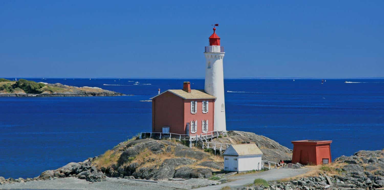
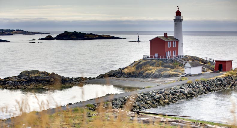
The Fisgard Lighthouse sits at the mouth of Esquimalt Harbour in Victoria, British Columbia. It was the first lighthouse ever constructed on the Canadian Pacific Coast, first sending out a beacon of light on November 16th of 1860.
George Davies was the first lighthouse keeper, followed by several others until the lighthouse was automated in 1929. Fisgard is a picturesque landmark with its bright red brick house attached to the white tower, which is also constructed of brick. Fisgard Lighthouse has been declared a National Historic Site and now operates as a huge tourist attraction by Parks Canada, along with neighboring Fort Rod Hill.
RACE ROCKS LIGHTHOUSE
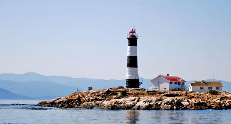
Located within an ecological reserve and marine protected area, Race Rocks Lighthouse is majestic icon on Vancouver Islandʼs coastline with its striking black and white striped tower rising above the sea. It is the second oldest lighthouse on the Canadian Pacific, with close-by Fisgard Lighthouse being only six weeks its senior. The lighthouseʼs lantern was lit for the first time on December 26 of 1860. It was a much needed beacon of light to guide ships moving down the sometimes treacherous Strait of Juan de Fuca in darkness or foggy conditions. Race Rocks is located 16km (10 miles) from Victoria, being passed by all ships coming from the open Pacific Ocean to ports in Victoria, Vancouver, Seattle, the Inside Passage, and other smaller destinations.
The lighthouse got its name from the extremely fast tidal movement past the rocky islets, which can reach 8 nautical miles an hour! Prior to the building of the lighthouse, several ships ran aground at Race Rocks and many lives were lost over the years. The lighthouse itself was constructed from granite blocks cut in Scotland and shipped over as ballast in a boat hauling timber. It is the only lighthouse on the Canadian Pacific that is constructed of stone. The contrasting black and white stripes were painted on the 24.4m tower by its first keeper, George Davies, because the lighthouse was said to be hard to see during the day when ships were traveling in from the west. At night the lighthouse lantern flashes once every 10 seconds, and in foggy conditions the foghorn blasts 3 times at one minute intervals.
Today Race Rocks is an Ecological Reserve and Marine Protected Area. It is home to a unique marine environment with a vast array of species of fish, marine invertebrates, birds, marine mammals and seaweeds. Throughout the whale watching season, it is common to find dozens of Stellarʼs Sea Lions, California Sea Lions and Harbour Seals either basking on the rocks or hunting for fish in the food rich waters. Occasionally we even see massive Elephant Seals using the small islands as a place to molt. Race Rocks tends to be a favourite spot for transient or mammal-hunting orca to scope out for unsuspecting seals or sea lions.
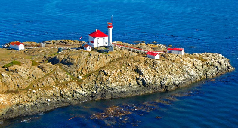
TRIAL ISLAND LIGHTHOUSE
Established as an ecological reserve in 1990, Trial Island Lighthouse is situated in the Strait of Juan de Fuca just off the shores of Oak Bay in Victoria, British Columbia. The lighthouse was built in 1906 to warn passing ships of the chain of islands and the shallow surrounding waters. The channel between Oak Bay and Trial Islandʼs rocky outcrops is only 300 feet wide with strong tides flowing through it. During war times, after British naval boats were refitted in Esquimalt Harbour, they were taken on a sea trial to test the repairs. The vessels sailed to the island and back and thus it was given the name Trial Island.
Trial Island was established as an Ecological Reserve in 1990. No private boats are allowed to dock on the islands and access is strictly regulated to protect the sensitive habitat and prevent the transfer of invasive species to the islands. This was done to protect the most overwhelming collection of rare and endangered fauna species in all of British Columbia. The islands are home to 28 species of plants that are listed as ʻrareʼ in the province, while 15 species of plants are included in the category of ʻgreatest rarityʼ. The island appeals to dozens of plump Harbour Seals, using the rocky shores as resting sites and birthing grounds. Every year we see the island being used by a nesting pair of bald eagles and their offspring. We have even spotted hawks perching on signs and logs on the islands.
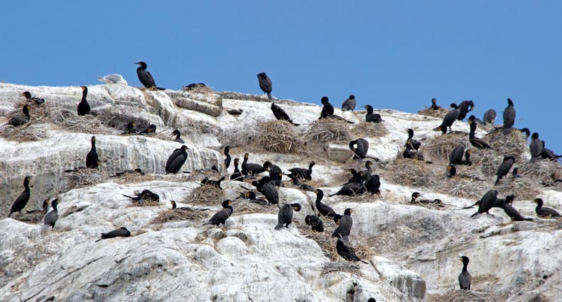
CHAIN ISLETS & GREAT CHAIN ISLAND
The Chain Islets and Great Chain Island lie between Trial Island and Discovery and Chatham Islands, 2km off the coast of Victoria, British Columbia. It consists of approximately 18 small rocky outcrops and the large Great Chain Island. During high tides, several of the islets disappear below the waterline.
Always visible around the Chain Islands, are huge beds of Bull Kelp where Harbour Seals play and hunt for fish. The Great Chain Island is the only island in the group that supports grasses and shrubs, including several rare species. The most impressive thing about the Chain Islands is that it hosts a globally significant population of Glaucous-winged gulls and a migratory population of Brandts Cormorants. The population of Glaucous-winged gulls on the islands is the largest in all of British Columbia, and the Brandts Cormorants represent 2% of the entire world population with approximately 2000 individuals.
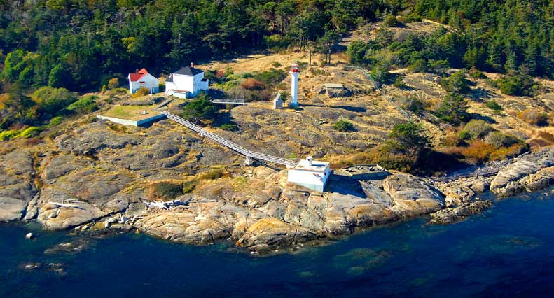
SEABIRD POINT LIGHTHOUSE & DISCOVERY ISLAND
Discovery Island lies in Canadian waters at the eastern end of the Strait of Juan de Fuca, marking the beginning of Haro Strait. It was named after British explorer Georges Vancouverʼs boat, the HMS Discovery, which explored the coast of British Columbia in 1846. Chatham Island lies next to Discovery Island, and was named after the HMS Discoveryʼs escort ship, the HMS Chatham. The island is a Marine Provincial Park, making it an attractive destination for kayakers and hikers who only have to paddle 3 miles over from Oak Bay. The northern side of the island is Songhees First Nations Reserve lands.
On the southeastern corner of the island stands the last lighthouse on the Canadian Pacific Coast, known as Seabird Point. This lighthouse was built in 1886, and hosted a year-round lighthouse keeper until it was automated 110 years later in 1996. It is not uncommon to find Harbour Seals and the occasional sea lion sprawled out on the islandʼs rocky shores. Shallow waters and kelp beds around the island make it a hot spot for grey whales to feed in when they are in the area. Tall trees on the island make it a haven for hunting bald eagles as well.
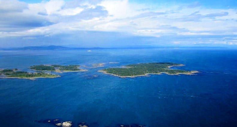
CHATHAM ISLAND
Chatham Island is located on the northern side of Discovery Island at the eastern edge of the Strait of Juan de Fuca. Similar to Discovery Island, it was named after the explorer Georges Vancouverʼs escort ship, the HMS Chatham.
Georges Vancouver explored the coastline of British Columbia between 1782 and 1794. The island is uninhabited and is under the control of the Songhees First Nation. The most interesting piece of history to do with Chatham Island is its role in the illegal transport of alcohol from Canada to the United States during the American prohibition from 1920 to 1933. Chatham Island contains a protected cove which got the nickname Rum-Runners Cove because Canadian bootleggers would hide containers of rum and Canadian whiskey in the cove and even in the water. American buyers would pick up the alcohol and smuggle it into the United States to sell to anxious buyers. There are even rumours that if you dive around Chatham Island, and if you’re lucky you can still find old bottles and barrels of rum and whiskey, aging to perfection!
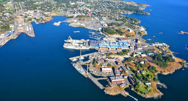
ESQUIMALT HARBOUR
The Esquimalt Harbour sits just west of the Victoria Harbour, and is home to the Canadian Pacific Naval Base. The harbour is rich in history as it is the site of the first landing of a European in Victoria.
Don Manuel Quimper of Spain first set foot here in 1790. It is also the oldest continuously operating dry-dock on the Pacific coast of North America. Esquimalt Harbour includes a large mud-flat area that is important to many species of waterfowl. Whales that visit the area have been known to enter Esquimalt Harbour, in fact a grey whale made the harbour home for several days during the summer of 2010.
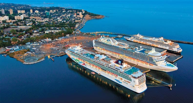
OGDEN POINT
Ogden Point is a deep water port for large boats and cruise ships located in Victoria Harbor. It also serves as a ship repair location and supply dock. Building of Ogden Point began in the early twentieth century when an increase in shipping was expected due to the opening of the Panama Canal.
The 2,500 foot long breakwall is the most iconic feature of Ogden Point with its red and white light beacon that guides boats into the harbour mouth. The wall was constructed in 1916 using 10,000 granite blocks along with additional concrete blocks, and over one million tons of rock. It was an expensive project for the time, costing $5 million. The breakwall is a popular dive site as it provides great habitat for marine invertebrates, seaweeds, fish, seals and most impressive- Pacific Giant Octopus! Thousands of people every year also enjoy walking on the breakwall, taking in the stunning view of the Olympic Mountains across the Strait of Juan de Fuca.
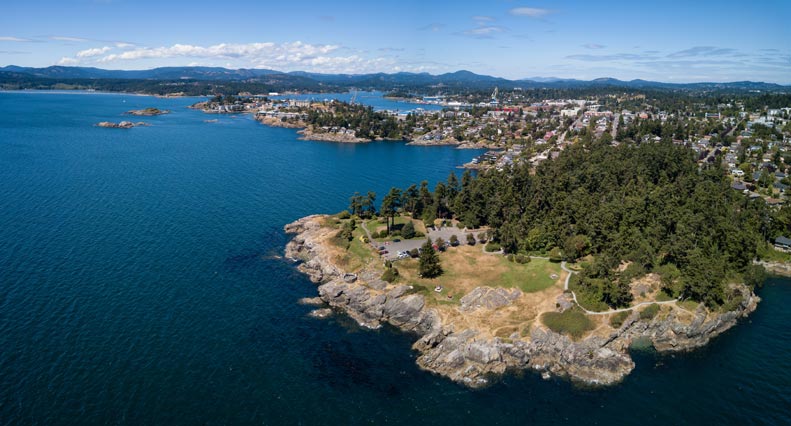
OAK BAY
Oak Bay is a seaside community on the eastern end of the city of Victoria. The Oak Bay marina is a protected bay where hundreds of boats moor year round.
The marina is a popular tourist attraction with its great views, restaurant, coffee shop, and gift boutiques. Whether walking along the docks or kayaking around the marina, it is easy to find Harbour Seals frolicking in the water or hoping to convince someone to throw them a fish with their big, puppy-dog eyes!
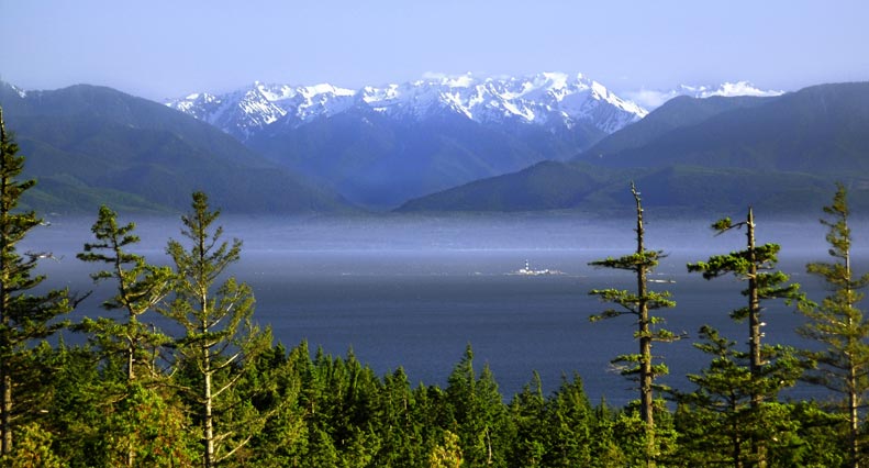
OLYMPIC MOUNTAINS
The Olympic Mountains rise from the Olympic Peninsula in Washington State, USA. The majority of the Olympic peaks are snow-capped year round. The highest mountain peak in the range is Mount Olympus, measuring 2427m (7962 feet) tall.
The western slopes of the Olympic Mountain Range make up the wettest place in the lower 48 states with 360-430cm (170 inches) of rainfall a year. Port Angeles is a town at the base of the Olympic Mountains which is accessible from Victoria via the Coho ferry. Forks is another town nestled in the Olympic Mountains that attracts many people as it is the setting for the popular Twilight series.
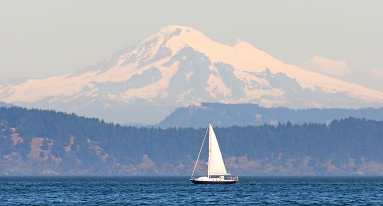
MOUNT BAKER
Mount Baker is one of the most picturesque landmarks east of Vancouver Island. It is one of the few mountain peaks that can be seen from Vancouver, Victoria and Seattle. The stunning peak towers 10,781 feet into the sky and is snow-covered year round. This ancient volcano is the 3rd highest peak in Washington State, and holds the world’s record snowfall level with 1140 inches in the winter of 1998-1999.
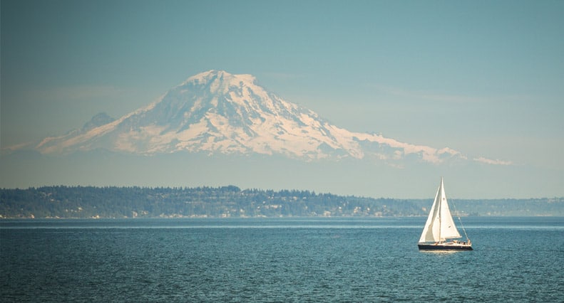
MOUNT RAINIER
Mount Rainier is part of the Cascade Mountain Range in Washington, USA. It is the highest volcanic peak in Washington at 14,410 feet. It is also the most glaciated mountain in the lower 48 states. Mount Rainier is only visible on very clear days, and appears as a massive white cone in the distance.
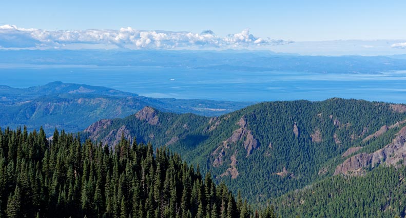
STRAIT OF JUAN DE FUCA
The Strait of Juan de Fuca is a 153 km (95 miles) long channel of water that lies between southern Vancouver Island and the Olympic Peninsula in Washington. It encompasses what is known as the Salish Sea and extends out to the open Pacific Ocean.
All vessels coming from the Pacific Ocean and heading to ports in Victoria, Vancouver, Seattle, the Inside Passage and other smaller locations must pass through the Strait of Juan de Fuca. It is known as the busiest shipping lane on the Pacific seaboard. This channel can experience rough seas due to exposure to westerly winds and waves from the open Pacific.
The straight acts as a passageway for many species of migrating salmon moving from the ocean to freshwater rivers to spawn, the Fraser River near Vancouver being the largest spawning river for salmon in the area. Resident orcaʼs diet mainly consists of salmon, so from April until November, Southern Resident Orca feast on the salmon coming through the Strait of Juan de Fuca. The Strait also acts as a resting ground and final feeding area for dozens of migrating humpback whales from late August until December.
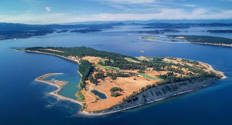
HARO STRAIT
Haro Strait is a channel of water that connects the Strait of Juan de Fuca and the Strait of Georgia. The Canadian-American border runs down the center of the straight. It is a major shipping lane for cargo ships, cruise liners, ferries, ecotourism boats and private vessels. Haro Strait runs along the western shores of San Juan Island, which is where the majority of whale watching trips are spent, watching resident orca feed, rest and socialize.
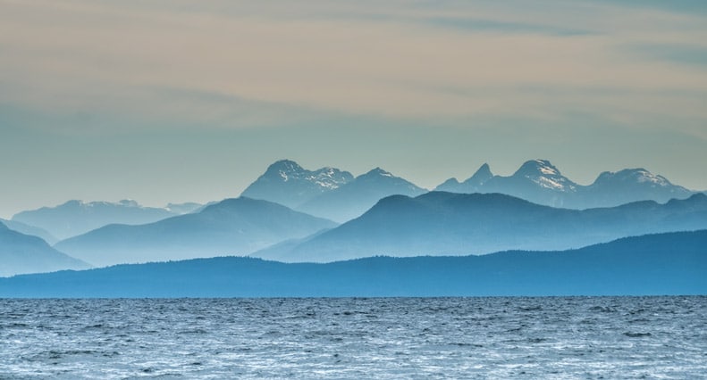
STRAIT OF GEORGIA
The Strait of Georgia is a body of water than runs 240km between Vancouver Island and mainland British Columbia. It is a major waterway for boat traffic heading between Victoria, Seattle and Vancouver. Because it is part of the route for migrating salmon coming from the open Pacific Ocean to spawning freshwater rivers, many species of marine mammals can be found here from spring until winter, especially resident orca!


